Showing posts with label Yoho National Park. Show all posts

Friday, 25 November 2011


Lake O'Hara in Yoho National Park, British Columbia provides picturesque scenery for any photographer. Lake O'Hara is across the Continental Divide from Lake Louise, and one of my favourite locations for vacation.

Photo Credit: swisscan CC=nc-sa-flickr. CLICK TO ENLARGE.

Monday, 24 October 2011


Emerald Lake in Yoho National Park, British Columbia taken early morning.

Photo Credit: tea but no e CC=flickr. CLICK TO ENLARGE

Monday, 15 August 2011


This photo is of Emerald Lake in Yoho National Park, British Columbia.

Photo Credit: Chris and Lara Pawluk cc=nc-nd-flickr.

Monday, 26 July 2010

My Town Monday - Kicking Horse Pass - The Big Hill


[1-Looking SW toward Kicking Horse Pass, Mt. Stephen on far right - click to enlarge]


When the Canadian Pacific Railway continued construction on its transcontinental railroad in 1885 the Big Hill was the most difficult portion of the route. It was located in the Canadian Rockies west of the Continental Divide and Kicking Horse Pass.


[2-CP Empress 2816 backing up before running Morant's Curve -click to enlarge]


The rail line route along the Kicking Horse River was considered the worst. From the west end of Wapta Lake the original survey revealed a uniform grade of 2.2% (116 feet to the mile) to Ottertail required a 1,400 foot tunnel through Mount Stephen and exposure to avalanche paths. The CPR realized that digging this tunnel would delay things for a year. This resulted in a temporary alternate route being built instead. The new route descended at 232 feet per mile or 4.5%, more than double, passing Wapta Lake to the base of Mount Stephen, along the Kicking Horse to a point just west of Field, then climbing again the meet the original survey at Muskeg Summit.


[3 - CP Empress 2816 crosses the Ottertail - click to enlarge]

Three special reverse grade dead end spurs to control runaway trains were built. Runaways and deaths did occur despite the safety precautions. The Big Hill between Field and Hector that ran for eight miles was ‘temporary’ for almost 25 years. It took four engines to get 710 tons up the grade. Trains were limited to a certain number of cars; freights were allowed more and passenger trains less. The route was dangerous and very expensive to operate. The remains of one accident can be found near the Kicking Horse River campground.

Trains loaded with heavy dining cars and sleeping cars were unable to climb the Big Hill, resulted in the CPR building rest stops at Mount Stephen House and Glacier House.


[4 - CP Empress 2816 entering Field - click to enlarge]


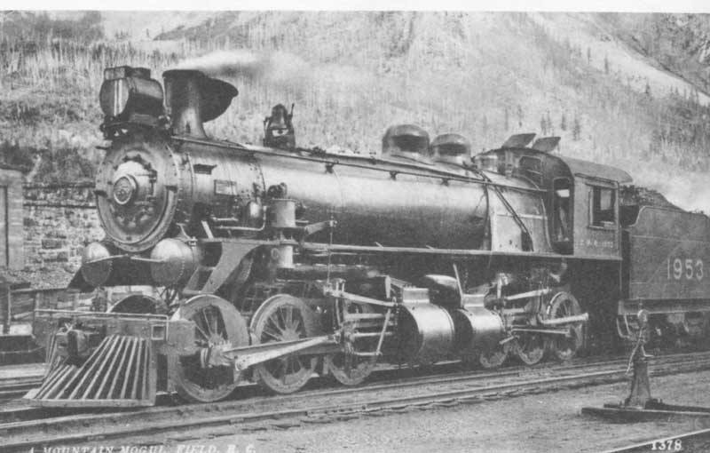
Special locomotives had to be built to haul the trains up the Big Hill. Heavy 2-8-0’s were enormous for their day, the first Consolidation type equipped with water brakes. Hundreds more would follow, larger and stronger, and were stationed at Field where a train stonehouse with turntable had been built for their storage and maintenance. Field had originally been known as the Third Siding until December 1884 when the CPR named it after C.W. Field, a Chicago businessman, whom they hoped would invest in their railroad.


[5 - Big Hill and CPR 1890]

Big Hill” on the CPR, 1890. Safety Switch No. 1 and its uphill spur are shown foreground and right; the truss bridge under the rear of the train, now known as the "Old Bridge", survives as a tourist attraction.

In 1909 the Big Hill was replaced by an engineering marvel, the Spiral Tunnels, reducing the grade to 2.2%, the norm for railroad tracks for maximum grade, at a cost of $1.5 million.


[6 - Spiral Tunnels in early 1920s - click to enlarge]

The tunnel under Cathedral mountain is 3255 feet long with a turn of 291 degrees, and the one under Mount Ogden turns through 217 degrees over 2992 feet. When the tunnels were bored, the measurements were off on one tunnel 1.5 feet when the two ends connected, and on the other tunnel, six inches.


[7 - CP Empress 2816 climbing rise to Spiral Tunnels - click to enlarge]


A bit of trivia about Mount Ogden: it was once the venue for a piano concert. A railway employee had been transferred and decided to move his small piano by loading it aboard a small push car. As he coasted through the lower tunnel he played his piano, much to the surprise of another railway employee who was patrolling the tunnel, watching for rockfall.


[8 - Spiral Tunnels map - click to enlarge]


There is a lookout just off the Trans-Canada Highway from which visitors can observe both portals of the tunnel. Passengers can ride this route, at least in the summer, on Great Canadian Railtours' "Rocky Mountaineer" train from Calgary to Vancouver.

For other participants for My Town Monday go here.


Sources: ParksCanada – Kicking Horse Pass Historical Site ,
TrainWeb.org
Wikipedia
Peakfinder.com
CP 2816 inaugural run 2001

Photo Credits: [1]-Matthew Klassen CC=nc-nd-flickr,[2][3][4][7]-Geoff S CC=nc-flickr, [5]-wikipedia, [6]-Sherlock77 (James) CC=nc-nd-flickr, [8]-Robert aka Bob CC=nc-nd-flickr.

Friday, 18 June 2010

Reflections (6)


This lake is near Lake O'Hara in Yoho National Park, British Columbia with the eastern face of Ringrose Mountain [3278m, 10,755 ft] in the background. Ringrose Mountain sits on the Continental Divide between B.C. and Alberta. Behind Ringrose Mountain on the Alberta side lies the Horseshoe Glacier and Sentinel Pass.

I have written hiking posts on Sentinel Pass and Goodsir Pass which is southwest of the lake in the photo.


Research: peakfinder.com, ParksCanada
Photo Credit: two_roads CC=nc-nd-flickr.

Thursday, 24 December 2009

Merry Christmas and Season's Greetings


This photo is in Yoho National Park, British Columbia taken after a snowfall.

For all my blog visitors and friends, may you have a Merry Christmas and enjoyable festivities over the holidays. I'm looking forward to roast turkey with all the trimmings with friends and family tomorrow, and, yes, the leftovers of turkey soup, turkey casserole, turkey pie. Sometimes over indulgence in food leaves one refusing later servings.

One year during my childhood, my mother was hospitalized for minor surgery as she was a teacher and couldn't really take time off during the other part of the year. My father, sensing a deal in cheap cranberries, bought a bushel worth. Taking over my mother's normal duty of Christmas dinner, my father made enough cranberry sauce, jelly and pies to last us six months. One of my brothers cannot eat cranberries today (50 years later).

Another Christmas, when I was in the hospital as a teenager, I ate a large box of Turtles over two days, and it took about 25 years before I could eat another one. Even now I rarely eat them.

Any of you ever have over indulgences at Christmas or holidays?


Photo Credit: Cuppojoe CC=nc-sa-flickr. Click to enlarge.

Sunday, 20 December 2009

Emerald Lake in Winter


This photo is of the Emerald Lake Lodge in Yoho National Park, neighbour to Banff National Park. For information about staying at the lodge here is the link.

To see Emerald Lake in the summer and a fisherman's paradise in an earlier post here.

Photo Credit: Cuppojoe CC=nc-sa-flickr. Click to enlarge.

Tuesday, 11 August 2009

Gone Fishin'


This is Mt. Michael and Lake O'Hara in Yoho National Park, British Columbia.

I will be absent from frequent posting or blog visiting for awhile as my writing will be taking precedence. There will still be the odd weekly post and, of course, book reviews, as there is a growing stack.


Photo Credit: listentoreason CC=nc-sa-flickr. CLICK TO ENLARGE

Friday, 24 April 2009

Bench of the Week


RuneE, a photographer, from Norway has begun posting photos of benches on Fridays. I thought I would join him today with a bench at an exquisite location: Lake O'Hara in Yoho National Park, British Columbia. Clicking on the photo will enlarge it for better viewing.


Photo Credit: Feffef CC=nc-sa-flickr.

Tuesday, 21 April 2009

Tuesday for Travis - Lake Mary


Lake Mary is adjacent to Lake O'Hara in Yoho National Park, British Columbia. Anglers are to have a Yoho National Park Fishing License.


Source: ParksCanada for Yoho

Photo Credit: Feffef CC=nc-sa-flickr.

Thursday, 18 December 2008

Hiking Trails - Wapta Falls


Wapta Falls is near the west end gate of Yoho National Park on the Kicking Horse River. From the TransCanada Highway it is an easy half hour hike one way going 7-kilometres round-trip. The Kicking Horse River drops 27 metres at its full height and is 61 metres across. Wapta Falls has the largest volume of water of all waterfalls in Yoho National Park; with the distinction in 1858 of being close to the spot where Kicking Horse Pass explorer James Hector was kicked in the chest while trying to recover a runaway horse. He recovered enough to push on with the expedition which proceeded to make the first recorded passage of what is now known as the Big Hill leading up into the Bow Valley from the present day location of Field. Expedition members aptly named the river The Kicking Horse.


Source:
http://www.field.ca/yohonationalpark/waterfalls/
Tales From The Canadian Rockies, Brian Patton (1994)

Photo Credits: pinkcanoe CC=nc-nd-flickr.

Thursday, 11 December 2008

Hiking Trails - Takakkaw Loop - Day 4

Trail is considered moderate
Closest Town: Field, BC

This hike takes place in Yoho National Park in British Columbia in western Canada. Today is the fourth day of a hike that began November 20th at the Takakkaw Falls.

This hike returns to Takakkaw Falls campground with stops at Point Lace Falls and Angel’s Staircase 5.2 km taking 2 plus hours. The hike begins at the Laughing Falls campground.

Just down stream from Laughing Falls is a bridge over the Yoho Valley River which is 4.2 km to Takakkaw Falls.


Fairy Falls are 4 km north of Takakkaw Falls

[1-Fairy Creek Falls]


[2–Trail to Angel’s Staircase Falls]


[3- Western Toad on hike] According to Wikipedia the Western toad or boreal toad (Bufo boreas) is a large toad species, between 5.6 and 13 cm long, of western North America. It has a white or cream dorsal stripe, and is dusky gray or greenish dorsally with skin glands concentrated within the dark blotches.

Breeding occurs between March and July in mountainous areas, and as early as January in lower-elevation regions. The female lays up to 17,000 eggs stuck together in strings that adhere to vegetation and other objects along water edges.

B. boreas is frequently encountered during the wet season on roads, or near water at other times. When handled adults often vocalize, making a sound like a peeping chick while struggling. It eats any type of insect it can catch. It also has a very long jump.


[4- Near end of trail to Angel's Staircase Falls]


Highlights of this trail include Angel's Staircase Falls, a 300 metre cascading creek,

[5-Angel's Staircase]


and Point Lace Falls, 13.5 metre curtain waterfall, which the hiker will find just off the main trail, a mile north of Takakkaw Falls.

[6-Point Lace Falls]


Upon reaching the main trail again, the hiker walks along a gravel track for a few km to complete the hike.

[7-Looking back up trail]


[8- Approaching Takakkaw Falls]


[9- Yoho River near campsite]


[10- Yoho River below Takakkaw Falls]


Source: ParksCanada www.pc.gov.ca
Photo Credits: [1][6]-brilang CC=nc-nd-flickr, [2][3][4][5][7]-cuppojoe CC=nc-sa-flickr, [8][10]-danielebneter CC=nc-flickr, [9]-inottawa CC=flickr,

Thursday, 4 December 2008

Hiking Trails - Takakkaw Loop - Day 3

Trail is considered moderate/intermediate
Closest Town: Field, BC

This hike takes place in Yoho National Park in British Columbia in western Canada. Today is the third day of a hike that began last week at the Takakkaw Falls.

The hike to Laughing Falls which is a short, leisurely walk of about 4.6km.

[1-Twin Falls - looking back from the trail]


[2-Yoho Valley trail]


[3-Chipmunk on rock]


[4-Bull Elk]


[5-Laughing Falls]


Laughing Falls campground has 8 camping sites with a privy and food storage pole.


Research: ParksCanada; field.ca/yohonationalpark.
Photo Credits: [1]-danielebneter CC=nc-flickr, [2][5]-brilang CC=nc-sa-flickr, [3]-Species Snob CC=nd-flickr, [4]-subindie CC=nc-nd-flickr.

Thursday, 27 November 2008

Hiking Trails - Takakkaw Loop - Day 2

Trail is considered intermediate/difficult
Closest Town: Field, BC

This hike takes place in Yoho National Park in British Columbia in western Canada. Today is the second day of a hike that began last week at the Takakkaw Falls.

This hike covers the trail to the Whaleback and on to the Twin Falls campground to stay overnight. The distance to be covered is 11.5km.

[1-Morning sun on peak above Little Yoho Valley Campground]


The Little Yoho is a hanging valley immediately behind President Mountain, above 2000m.


[2-Bright sunshine in morning in the Little Yoho Valley]


[3-Waterfall in Little Yoho Valley near campground in morning light]


[4-Looking up Little Yoho Valley from the Stanley Mitchell Hut]


The Stanley Mitchell Hut is operated by the Alpine Club of Canada. Members can enjoy their stay with sleeping space for 26 in summer (22 in winter), well equipped with a woodstove, propane system for cooking and lighting. The Little Yoho Valley has long had a reputation as an excellent alpine climbing area as well as a magnificent skiing area. The Canadian military used the area during the summer of 1943 as a training site for mountaineering techniques.

[5- Stanley Mitchell Hut kitchen]


The hut has undergone a few renovations, but is relatively the same as it was in 1940. It is presently in excellent condition; a comfortable facility set in beautiful meadow and mountain terrain, and a fine memorial to one of the Club's founders. The Stanley Mitchell hut was designated a Federal Heritage Building in 1997.


[6- Stanley Mitchell hut living room]


Water can be obtained from the spring-fed stream behind the Stanley Mitchell Hut. It is recommended this water be boiled before drinking.

The first 2.5 kms east from Little Yoho is a comfortable hike through a thick forest. Keep a lookout for bears.

The hiker will approach a three-way junction. For the Whaleback Trail take the left turn. From here the trail becomes very steep with switchbacks over loose rock, roots and other obstacles while climbing over Whaleback Mountain.

[7-Whaleback trail]


[8- Whaleback Trail with summit in sight]


The end is close, as there is a glimpse of the trail summit. The Whaleback Trail goes as high as 2300 metres (7,545 ft), the mountain summit is at 2,633m (8,638ft).


[9-Whaleback Trail summit]


The reward on reaching the top is the scenic highlight of the Yoho Valley which is 2 kilometres away. At the top you will enjoy panoramic views of the valley including the Daly Glacier, Yoho Peak, Mt. Daly, Yoho Glacier.

On the other side The Vice-Presdient and The President Mountain (peak on right) can be seen with Emerald Glacier.


[10-The Vice-President and The President, 3,132m (10,246 ft) behind Emerald Glacier]


Another available view is of Mount Des Poilus, named in honour of the million and a half privates in the French army who were killed in the First World War, and the Des Poilus Glacier.

[11-View of south ridge of Des Poilus]


[12-Top of Twin Falls]

This seasonal bridge lies over the river that topples over into the "Twin Falls."


[13-Another view from the bridge looking out over the Yoho Valley]


Farther along the hiker will cross Twin Falls creek above the falls courtesy of a seasonal bridge that is only available in summer. There the hiker can stand at the top of the falls to look across the Yoho Valley.


[14-Whaleback Trail on edge of unprotected cliff 100 metres above the Twin Falls Chalet]


The trail parallels the edge of a cliff where there is a good location to have a lunch break after the strenuous exertion of climbing the Whaleback.

For the descent there are about 4km of steep switchbacks through the forest which will take the hiker to the valley bottom. It is important to be careful going down.

[15-Twin Falls]


[16-Twin Falls lower and streamlet]


[17- Twin Falls Chalet]


To reach the Twin Falls campground, the hiker will pass the Twin Falls Chalet, originally a teahouse built in 1908 by the Canadian Pacific Railway to accommodate travelers in the Canadian Rockies. Yoho National Park now owns the Twin Falls Chalet, operating it as a backcountry lodge open july to September (Labour Day). There is another 60m on a steep descent before you reach Twin Falls campground.

The Twin Falls campground has 8 camping sites with a privy and food storage pole.

If you have time, there is a short hike (2.3km) with an elevation gain of 250m from the campground to the edge of Yoho Glacier.

[18-Near edge of Yoho Glacier]


Reservations must be made three months in advance to stay overnight in the backcountry campgrounds. A wilderness pass must also be purchased ($9.90 overnight or $69.35 seasonally) to stay overnight in Yoho National Park. These may be purchased through ParksCanada.


Research: field.ca/yohonationalpark; alpineclubofcanada.ca; ParksCanada; wikipedia.
Photo Credits: [1]-inottawa CC=flickr, [2][3][4]-brilang CC=nc-sa-flickr, [5][6][10]-wikipedia, [7][8][14][15]-damclean CC=nc-sa-flickr, [9][12]-pinkcanoe CC=nc-nd-flickr, [11][16]-mikewarren CC=nc-sa-flickr, [13][17]-jason rust CC=nc-nd-flickr, [18]-jondon CC=nc-nd-flickr.