Saturday 19 December 2015

Kettle Valley Rail Trail


The Kettle Valley Rail Trail is an abandoned railway bed that winds through central British Columbia between Midway and Hope. The 600km route offers the cyclist or hiker unique trail experiences: tunnels, trestles moving through mountain forests and a small desert. With the many camping facilities along the trail allows for extended trips or weekends.

Myra Canyon near Kelowna, B.C. has a series of 18 trestles on this portion of the picturesque trail. It may pose a challenge for those with fear of heights.


KettlevalleyRailway.ca

Photo Credit: wikipedia

Monday 26 October 2015

Graydon Hall Park

This 5.3 hectare (13 acres) park is located at 215 Graydon Hall Drive, North York on a plateau near Don Mills Road and the 401. It can be reached by the 122 Graydon Hall bus which stops on either the west or east side of the road.


One hundred acres of farmland was purchased by the successful businessman, Rupert Bain, and transformed into the Graydon Hall estate. Graydon Hall, itself, was completed in 1936 at a cost of $250,000, an extraordinary sum for the time. This was followed by landscaping, and a 9-hole golf course, terraced pools in a garden area at the rear of the mansion. Bain was an avid polo player and a master of hounds at the Eglinton Hunt Club.

A large part of the Graydon Hall manor property was sold to EP Taylor on which he built stables, kennels, polo field, and race track in 1950. In 1951, the mansion house and grounds were sold to Nelson Morgan Davis to Intercity Forwarders. In 1952, Bain died of a cerebral hemorrhage after a riding accident.


Near the sign to the park is a pathway that goes behind the mansion along the southern edge of it.


The path leads past thick wooded and brush filled areas.


Leading to the rear of the mansion is a break off path through close underbrush.


After a short walk over a lush well kept lawn between two rows of trees bordered by low stone walls is an iron fence protecting the grounds of the Graydon Hall Manor.


Research: Sheridan Nurseries: One Hundred Years of People, Plans and Plants. By Edward Butts, Karl Stennson. Pp 100- http://www.torontoneighbourhoods.net/neighbourhoods/north-york/graydon

Photo Credit: BEMartin2015

Monday 20 July 2015

On the weekend, a friend took me out to a farm near Caledon, north-west of Toronto to pick strawberries for an hour or so. As a child I had gone to the Okanogan in British Columbia to pick apples and pears from the trees in the orchard fields.


It wasn't much different. Instead of walking into the orchard to find the trees laden with ripe pears and apples, the farm provided a tractor and wagon with benches to take the pickers out to the fields, about 800 yards from the gate.


The scene and trip reminded me of John Steinback's novel "The Grapes of Wrath".


The berry picking went well, as there were plenty of ripe strawberries to be had in the numerous rows. In less than an hour, we had a full basket, and it was back to the gate to weigh in. The cost was $2.50/lb, with the basket coming to $15.00.


Also, at the farm were an assortment of pens of farm animals: a donkey (looked more like a burro as it was smaller than any donkey I had seen before), two goats, and some horses. I apologize for the photo of the goat who wasn't very co-operative as she was more interested in eating the grass at the edge of the fence and any strawberries children happened to drop specifically for her.


As for the strawberries when I got home, were a nice treat -- I must say they are alot better than the store bought ones. Perhaps a bit smaller, but juicier with more flavour.

Photo Credits: ©BEMartin2015

Monday 13 July 2015

John Scadding's Cabin

[1]

Last year, while at Toronto’s Canadian National Exhibition with a friend, I stopped by to see the Scadding Cabin, located near Lake Shore Blvd. West to the southern portion of the grounds. In 2009 I had written a more comprehensive account of the history behind the Cabin and its exposure at the Toronto Industrial Exhibition held in 1879.


[2]

The log cabin, built in 1794, was first owned by John Scadding, a government clerk and close friend to Upper Canada’s first Lieutenant Governor, John Graves Simcoe. The cabin was located on Scadding’s 253-acre property on the east bank of the Don River near where Queen Street and the Don Valley Parkway cross today. Scadding lived on the property until 1796 when he returned to England with the Simcoes.

[3]

When John Scadding returned to York in 1818, he sold the property and its cabin to farmer William Smith, who used the cabin as an outbuilding. In 1879, Smith offered the cabin to the 10-year old York Pioneers Association.


[4]

In the summer of 1879, the York Pioneers dismantled the cabin and reassembled it at the location of the inaugural Toronto Industrial Exhibition now the grounds of the Canadian National Exhibition.

[5]

Volunteers from the York Pioneer and Historical Society dress in period costume to explain about the artifacts in the cabin.

At the time I visited, no one was allowed up to the second floor or bedroom area. Considering the narrowness of the stairs to the south it might pose a hazard to someone venturing up them.


Photo Credits: [1} Wikipedia Commons, [2][3][4][5]-©BEMartin2014

Research:

1894 Toronto's Industrial Exhibition

York Pioneers

Toronto Plaques


Thursday 25 June 2015

Hiking the Sundance Canyon Trail - Banff


[1]


Trail Length: 4.3 km taking about 3 hours
Elevation Gain: 145 m (470 ft)
Maximum elevation: 1545 m (5,070 ft)
Maps: Banff Up-Close (Gem Trek)


Check trail and bear conditions from Parks Canada before setting out. Recently the population of grizzly bears has increased and are more often encountered and seen around the Banff townsite. An article in the Calgary Herald in August 2013 reported an incident where a very large grizzly bear (225-275 kilogram) killed and ate a small 45-kilogram black bear that had been foraging on the trail.


From the intersection at the south end of the Bow River bridge make a right turn onto Cave Avenue. Go 1.2 km to the parking lot where a paved walkway leads to the Historic Cave and Basin site. Walk past to get to the hiking and bicycle path.

Some years ago, the paved road to Sundance Canyon was open to vehicular traffic. However, now it is used only by hikers, horses and those who wish to bicycle or use roller blades.

The first portion of the trail leads down to the Bow River.


[2]


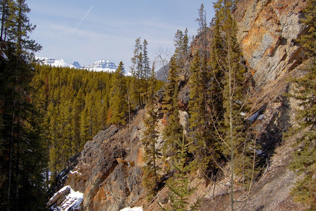
For about 1.5 km the trail follows the shoreline of the Bow River before turning south toward Sundance Canyon. Views of Mt. Cory 2789m, Mount Edith 2554m (the spike top), Mt. Norquay 2525m can be seen to the north.


[3]


[4]


[5]


[6]


The trail and bicycle access ends at the Sundance Canyon picnic area. There a 1.2 km foot trail climbs into this canyon, bridging the Sundance Creek, and looping back down the other side of the canyon.


[7]


Just before the trail loops around there is a fork leading off through Sundance Pass to swing around the southern end of Sulphur Mountain to the Spray River for those considering that route.


Photo Credits: [1] melanie CC=nc-flickr, [2][3][4] eric titcombe CC=flickr, [5][6] John Vetterli CC-nc-nd-flickr, [7] casium CC=nc-nd-flickr.

Research: ParksCanada

Sunday 14 June 2015


Have you ever noticed that when arrangements are made to go somewhere, especially those plans made earlier in the year or the year before -- seem to go awry just before one is about to depart. Perhaps I should just go on the spur of the moment and hope for the best; something I did when younger -- and it worked out just fine.

The photo is from a post about hiking the Rockwall Pass in Kootenay National Park in British Columbia.


Photo Credit: nordique CC=flickr.

Wednesday 3 June 2015

Earl Bales Park


Earl Bales Park is one of 1,600 parks within the Toronto area.

Named after Robert Earl Bales a former mayor of North York, the park is located on the former farmland of his great-grandfather, John Bales.

One of the nicer features of this park is the amphitheatre, where last summer I enjoyed a one-man show with a unique performance on a unicycle.

There are two fire pits, dog off leash area, two playgrounds, five parking lots, nine bike trails and a senior recreation centre with washrooms. In the winter for ski enthusiasts there are ski runs, a ski chalet and a chair lift.


Research: Toronto.ca/parks

Photo Credit: bemartin © 2014

Wednesday 27 May 2015

Sheep River Provincial Park


Sheep River Provincial Park is located 106km SW of Calgary in Alberta. Take highways AB-22 and AB-546W, or AB-2A south to Otokoks, then west on AB-7 to Black Diamond and at Turner Valley to AB-546W, leaving 36km.

Sheep River is part of the Bow River watershed, providing drinking water to the towns of Turner Valley, Black Diamond and Okotoks.

The Sheep Falls are located near the Bluerock Campground and the Indian Oils Trail on the Sheep River Road at the western portion of the Park.

The park is open May 15 to November 30th each year which assists the Bighorn Mountain Sheep in maintaining their herd numbers. For the avid outdoors person there is camping, hiking, biking/cycling, fishing, horseback riding, and, of course, photographing birds and spectacular landscapes. For fishing enthusiasts a fishing license is required, and there is a catch and release in effect. This park is home to Cutthroat Trout, Bull Trout and Rainbow Trout. For the hiker often deer, elk, bear and Bighorn Sheep are seen.

For hikers there is information on the trails with Alberta Parks showing the degree of difficulty and more information. Group hiking is essential as this is bear country!

Historically, in 1884 to 1885 John Ware worked for the Quorn Ranch located on the Sheep River.

Photo Credit: phoven CC=flickr.

Research: wikipedia

AlbertaParks.ca

Thursday 21 May 2015

Plains Bison in Banff National Park


Plains bison were reintroduced into Banff National Park in March 2015.


For those unable to watch embedded see here.


In the mid-1800s the majority of Plains Bison had been eliminated from the continent except for a few free ranging herds. They have always had a role in the ecosystem by their creation and maintenance of grasslands and meadows through grazing and physical disturbance of the ground. Bison are also a food source to predators.

The First Nations and pioneers benefited from the bison in years past. This reintroduction will assist the cultural reconnection which has been lost for over a century.

A long-term maximum population for Banff will be in the range of 600 – 1,000 individuals. To protect the initial relocation area it will only be accessed by established trails on foot or on horseback. For those who venture too closely the bison can create safety risks such as human fatalities. They weigh 450-900 kilograms, are agile for their size and capable of speeds up to 70 kilometres an hour. The areas of “the Panther and Red Deer River valleys, and the Fairholme Bench area of the lower Bow Valley” are locations that have the appropriate range habitat to support the bison.

The first phase of the reintroduction includes placing 30-50 bison in a temporary soft release paddock in the Panther-Dormer River area in the summer/fall. These plains bison will come from the herd at Elk Island National Park. The phasing in period will be over the next five years and beyond. Currently the Dormer River Valley is closed for prescribed fired burnings which will enhance new vegetation growth for the plains bison to be placed there.

This is exciting as it has been quite some time that Banff National Park has had the plains bison available to the public. During some of my early visits to Banff in childhood (late 1950s-1962), I recall seeing the plains bison in the various paddocks.


Research: ParksCanada

Friday 15 May 2015

Couchiching Beach Park


At the beginning of May, a friend drove me up to Orillia for a short visit in beautiful sunshine. The trees had only barely begun to open their leaf buds.

This 14.5 acre park is located in the City of Orillia, Ontario, 80 miles / 129 kilometres north of Toronto on the west side of Couchiching Lake. It has a swimming beach, flower gardens, band shelter, picnic tables, fishing, trails/pathways, 66 benches, outdoor skating rink in winter and includes the town dock.

East of the lake in the next photo on the green shore line is Casino Rama.


Couchiching is from the Ojibwe word gojijiing meaning “inlet” and is separated from Lake Simcoe to the south by a narrow channel.

The area was first mapped by Samuel de Champlain between 1613 and 1615.

For those interested, I had previously posted historical articles on Samuel de Champlain:
Part 1, Part 2, Part 3, Part 4, and Part 5.


Photo Credits: bemartin (C)2015.

Research:
http://www.orillia.ca/en/livinginorillia/communityparks.asp
http://en.wikipedia.org/wiki/Lake_Couchiching
http://www.canadahistory.com/sections/eras/2%20worlds%20meet/champlain/Champlain.html


Sunday 10 May 2015

Cascade Gardens


The Banff Administration Building is located on the south side of the Bow River across the Bow River Bridge. The Cascade Gardens surround the stone building and are built into the hillside of Sulphur Mountain. These gardens offer spectacular views of the Bow River and the surrounding mountains.

More information on summer and winter activities can be located in Parks Canada's brochures.


Photo Credit: Fred Hsu CC=flickr

Sunday 8 February 2015

Wascana Trails


The Wascana Trails are located NW of Regina along a deep ravine in the Qu'Appelle River Valley. They are part of the Wascana Valley Nature Recreation Site, covering 15km of varied terrain of hills with steep and winding ascents and descents providing excellent views of the river valley.

Wheelchair access by hand cycle on North America's first off-road hand cycle trail.


Directions from Trailpeak.com:

"Go NW of Regina on Highway #11 about 10.5km past where it turns off of Albert (#6). Turn West on secondary Highway 734. At 7.7km where the Highway takes a hard right to the N, go straight (watch for cars as I KNOW you'll be thinking of singletrack) down the gravel road. Another 1.8km (around a couple left hand turns) and you will find the well marked parking lot. There are a few signs on the way so you won't get lost."


Research: TourismSaskatchewan dot com

Photo Credit: davidgane CC=nc-nd-flickr. CLICK TO ENLARGE.

Thursday 5 February 2015

Prudhomme Lake


Although closed at this time of the year, Prudhomme Lake in Prudhomme Lake Provincial Park in British Columbia, offers respite from the cities in the summer. Located 16km east of Prince Rupert, this park covers 7 hectares with ample campground sites to enjoy fishing of five species of Pacific Salmon. Salmon spawning occurs in August and September.


Photo Credit: DreamEchos CC=nc-flickr. CLICK TO ENLARGE


Saturday 3 January 2015

Winter Necessity


Often in the winter months in western Canada, or in northern areas of Ontario and Quebec, plug-ins are necessary to keep engine blocks from freezing.

Winter has plagued western and eastern Canada in strange bursts of frigid weather combined with snow and freezing rain, followed by warmer weather. One never knows how the week will turn out, or just when that next heavy snowfall warning occurs.


Photo Credit: banff_lake_louise CC=nc-nd-flickr.