Showing posts with label First Nations. Show all posts

Sunday, 25 August 2013

Runnymede Public Library - Toronto


Early in July I paused outside the Runnymede Public Library, at Bloor St West and Glendonwynne, where the art deco around the front door caught my eye. Inside one of the librarians was kind enough to assist me in locating information about the architect, one, John M. Lyle.

Mr. Lyle was born in Ireland in 1872, came to Canada at an early age. He was the first architect to use Canadian style, designing the high pitched French Canadian type of roof tiled with the ordinary small black slats used in France. The walls of the library were constructed from the local Credit Valley limestone, grey stone with hints of yellow and red in its texture. Construction began in 1929 and was completed in 1930.

The art deco around the front door was done in a First Nations totem motif: the raven, the beaver and the bear on the bottom.


On the west side of the library is a door that once led into the children’s portion of the library where special spaces (club rooms) were allocated for their activities.

A few of Mr. Lyle’s other creative works in Toronto are the Royal Alexandra Theatre and Union Station which share the similar style of the Runnymede Public Library.


References:

John M. Lyle: Toward A Canadian Architecture by Geoffrey Hunt, Publisher Agnes Etherington Art Centre, Queen’s University, Kingston, Ontario 1982: pp.6, 10.

A Progressive Traditionalist John M. Lyle, Architect by Glenn McArthur, Coach House Books, Toronto, 2009. pp. 152.

Photo Credit: B E Martin All Rights Reserved.

Tuesday, 18 December 2012

Bald Eagle


Bald eagles have a wing span of 80 inches with a body length of about 31 inches. This bird prefers open or wooded areas close to water. They tend to mate for life, raising 1 to 3 chicks in an eyrie 150 feet off the ground in a tree. Some nests weigh up to 1,000 pounds.

In the culture of the First Nations, including the Haida on the west coast in British Columbia, the eagle is revered as a bird of power and strength. The eagle also represents strength, courage, honesty, truth, majesty, wisdom and freedom. The traditional legends believe the eagle is a messenger of God, carrying prayers from men of the earth. It is a great privilege to receive an eagle feather, representing gratitude, love and respect.

The Haida have lineages under either "eagles" or "ravens" and use these birds as crests on their totem poles. The animals beneath them belong to the lineage of the family.

Unfortunately, these birds remain on the endangered species list despite a remarkable comeback.

Reference: http://dcp.psc.gov/ccbulletin/articles/AIANCOLogo.htm ;
http://www.haidadesigns.com/culture.htm ;
A Field Guide to the Birds of North America by Michael Vanner, Paragon Publishing (2006), p.77

Photo Credit:  Chris and Lara Pawluk CC=nc-nd-flickr (Bald Eagle in the Rockies)

Wednesday, 18 January 2012

Winter Means Snow


The winter weather has so far astounded me, at least as far as Toronto is concerned. I'm quite familiar with snow, frigid temperatures combined with blustery winds during the northern hemisphere's winters. This year has been a huge exception: almost balmy some days with rain followed by an odd day of colder temperatures with little snow only to change in an day or so to above freezing temperatures combined with rain showers. I wonder how the trees and bushes cope with such modified weather. Even the squirrels are out foraging.

The Mallards that inhabit the nearby creek don't seem to mind as long as they can paddle happily in free moving water. Though they do quite well with walking on ice. It's quite the sight to see them bobbing their heads in the water to cleanse themselves. A little too frigid for me.

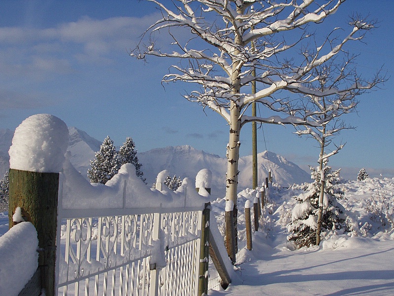
The photo is taken near the Flathead Range in the Crowsnest Pass in winter. The Flathead Range makes up part of the Continental Divide between Alberta and British Columbia.

For history buffs courtesy of Peakfinder.com: "The Flathead Range was named in 1924 after a tribe of Indians that lived in northwestern Montana. Some members of the tribe wrapped the soft-boned heads of their infants against a board so as to shape their skulls in a preferred manner."

Photo Credit: tipkodi CC=nc-flickr. Click to enlarge.

Monday, 27 July 2009

My Town Monday - Samuel B. Steele - Fort Walsh

[1-Cypress Hills]

Fort Walsh became the headquarters of the North-West Mounted Police in 1878, with its beginnings as a fur trading post in 1873. The fort is named after Superintendent James Walsh . The fort was later moved to Maple Creek, Saskatchewan where the railroad was. The fort was used in 1948 to 1962 for the RCMP to breed horses for the musical ride and the force.


[2- Historic Site - Fort Walsh at Cypress Hills Provincial Park]


[3 - Fort Walsh bunk house]


[4 -Fort Walsh Officer's Quarters]


[5 -Fort Walsh bunk house]


In 1875, Inspector James Morrow Walsh with about 30 men were sent to the Cypress Hills region where they built Fort Walsh, not far from where the Cypress Hills Massacre occurred. The NWMP investigation revealed that American “wolfers” (poisoned wolves for their pelts) and horse thieves had instigated the massacre. Although the NWMP were unable to convict any of the participants, the First Nations appreciated the efforts resulting in a good relationship. This resulted in the eventual signing of Treaty 4 in 1877, and Treaty 6 in 1879 and 1882.


[6 - click to enlarge]


[7 - Fort Walsh old book]


[8 - Fort Walsh - Photo of Queen Victoria]


[9 -Sitting Bull]


The country near Fort Walsh was the location where Sitting Bull, Medicine Man, and 5,000 Lakota Sioux followers took refuge from the US Army after the battle of the Little Big Horn in 1876. Walsh was instrumental in ensuring Canadian law was enforced, and peace maintained between the Canadian and American First Nations. When Sitting Bull continued to refuse to leave Canada for the US, Walsh was accused of neglecting his duties to get the Sioux to leave. To separate Walsh from Sitting Bull, whom he had become close friends with, Walsh had been sent to Ontario and later forced to resign from the NWMP due to his “too friendly association” with Sitting Bull and the Sioux. A letter Colonel James Macleod wrote to his wife, Mary, on July 29, 1878 sums up his opinion of Walsh’s association with the Sioux. Sitting Bull and the majority of Sioux refugees returned to the US in 1881 when the federal government refused to provide supplies and food when the buffalo had declined in numbers, almost to extinction.


[10 -Cypress Hills wildflower]


[11 - Cypress Hills is known for star gazing - Aurora]


My Town Mondays were started by Travis Erwin in Amarillo, Texas who has handed the reins over to Clair Dickson. For other participants please visit the new location here.


TO BE CONTINUED

For previous posts on this series: Part 1, Part 2, Part 3, Part 4, Part 5, Part 6.

Sources:
Forty Years In Canada by Col. Samuel B. Steele (1915) [pp. 160, 161]
Glenbow Museum Archives
ParksCanada – National Historic Site

Photo Credits: [1][2][3][5][7][8]-Space Ritual CC=nd-flickr, [4][6]-bribriTO CC=sa-flickr, [9]-wikipedia, [10]-kiwehowin CC=nd-sa-flickr, [11]-Kevin Satt CC=sa-flickr.

Wednesday, 28 January 2009

Samuel de Champlain - Part 2


[1-Samuel de Champlain (c. 1575 - 25 December 1635) by Roynat]


In the spring of 1608, three ships left the French port of Honfleur, one of them, the Don-de-Dieu (the Gift of God), commanded by Champlain.


[2-Tadoussac by Bete a Bon-Dieu]

In June, the small group of settlers arrived at Tadoussac (photo). There, they left the ships and continued to Quebec in small boats. In Algonquin, “Quebec” means “the place where the river narrows”. On July 3, 1608, Champlain and a party of workmen landed at the foot of Cap Diamant, the rock that now dominates Quebec City to build a cluster of fortified buildings: three main buildings (each two stories tall), to which he referred collectively as "l'Habitation", and also a moat 12 feet (4 m) wide. This was to become the city of Quebec. Twenty of Champlain’s twenty-eight men died the first winter.

The native nations of Canada had since the early 1500s traded furs for iron axes, copper pots, cloth and decorative beads brought by visiting fishermen and traders. For control of this trade, they had fought bloody wars, which by 1600 made the St. Lawrence valley a no-man’s land hotly contested by two Native Alliances.

One of the Alliances was the League of the Five Nations, or Iroquois Confederacy, a farming and trading society of about 30,000 people. The Iroquois lived in what is today New York state with a network of allied tribes covered the area south of the St. Lawrence River. The other Native Alliance lay north of the St. Lawrence River.

The most powerful were the Huron Confederacy on the Georgian Bay shores of Lake Huron. The 20,000 Huron (or Wendat, as they called themselves) resembled the Iroquois in their language, agriculture and sophisticated politicial confederacies. The Huron and Iroquois Confederacies were long standing rivals for power and influence. The Huron Montagnais who were hunting and gathering tribes were most familiar with the French.

[3]
The French persuaded the Huron that a permanent French presence would be a bulwark against their rivals. For Champlain to see his colony grow and survive, he demonstrated its usefulness to his Native allies, the Montagnais, and in July 1609 he set forth to aid them by making war on the Iroquois. He was accompanied by 9 French soldiers and 300 hundred Algonquins and Hurons to explore the Rivière des Iroquois (now Richelieu River) (photo) when he subsequently mapped Lake Champlain. Having had no encounters with the Iroquois at this point, many of the men headed back, leaving Champlain with only 2 Frenchmen and 60 natives.


[4-Champlain Map of Richelieu River to Lake Champlain]


Encountering rival Five-Nations Iroquois on the shores of Lake Champlain, the Algonquins and Hurons prevailed in a brief battle. Champlain assisted by using his firearm, a clumsy arquebus, [photo] to intimidate the enemy. His first shot killed three Iroquois leaders, resulting in victory and an established presence for security of trade on the St. Lawrence River. The French and Huron became close partners for the next one hundred years.


[5- The arquebus (sometimes spelled harquebus, harkbus or hackbut; from Dutch haakbus, meaning "hook gun") is an early muzzle-loaded firearm used in the 15th to 17th centuries. In distinction from its predecessor, the hand cannon, it has a matchlock. Like its successor, the musket, it is a smoothbore firearm, but it is lighter and easier to carry. It is a forerunner of the rifle and other longarm firearms.]

After this expedition, he returned to France in an unsuccessful attempt, with the Sieur de Monts, to renew their fur trade monopoly. They did, however, form a society with some Rouen merchants, in which Quebec would become an exclusive warehouse for their fur trade and, in return, the Rouen merchants would support the settlement.

He was also integral in opening North America to French trade, especially the fur trade, more particularly the beaver felt hat which became popular as a staple of commerce. The beaver hat remained firm, waterproof and durable in any shape or style.*


Sources: wikipedia
Library and Archives Canada here
*The Illustrated History of Canada, edited by Craig Brown, pp. 99-101.

Photo Credits: Wikipedia.

CONTINUED

Wednesday, 21 January 2009

Samuel de Champlain - Part 1


[1-Samuel de Champlain by Ronjat]

Samuel de Champlain (c. 1575 - 25 December 1635), known as "The Father of New France", was a French navigator, geographer, cartographer, draughtsman, soldier, explorer, ethnologist, diplomat, chronicler, and the founder of Quebec City on July 3, 1608, of which he was the administrator for the rest of his life. It is from Champlain’s published accounts of his voyages that established him as an explorer and geographer.

Champlain arrived on board the Bonne-Renommée (the Good Fame) on his first trip to North America on 15 March 1603, as an observer, with members of a fur-trading expedition. Although he had no official assignment on the voyage commanded by François Gravé Du Pont, he created a map of the St. Lawrence River and after his return to France on September 20th, wrote an account published as Des Sauvages: ou voyage de Samuel Champlain, de Brouages, faite en la France nouvelle l'an 1603 ("Concerning the Savages: or travels of Samuel Champlain, of Brouages, made in New France the year 1603").

[2-King Henri IV of France]

When asked by King Henri IV to make a report on his further discoveries, Champlain joined a second expedition to New France in the spring of 1604 led by Pierre Dugua, Sieur de Monts, a Protestant merchant given fur trade monopoly in new France. They chose as their base the tiny Ile Ste-Croix in the southwestern corner of modern-day New Brunswick. After a disastrous winter in what turned out to be a most inhospitable location, the remnants of the community migrated to a more congenial site across the Baie Française (Bay of Fundy), settling in a location they named Port Royal. Champlain remained at the site until 1607, while he explored the Atlantic coast.

[3- Port Royal Habitation]


[4- Port Royal Habitation courtyard]


The Port-Royal Habitation was constructed during the summer of 1605; consisting of several buildings grouped, French-fashion, in a four-sided arrangement around a central courtyard. Although this new community did not last long, it was the earliest European settlement of any permanence in North America, north of Florida, and it introduced a way of life that was both innovative and unique for its time and place.

[5-Port Royal Habitation]


[6- Port Royal Habitation Kitchen]

The Port Royal Habitation is the reconstruction of early 17th century buildings representing the former colony of the French who settled for a time on the Nova Scotia coast.


[7 - Port Royal Habitation- Sieur de Champlain quarters]


[8-Chatham, Cape Cod present]

In 1605 and 1606, Champlain explored the land that is now Chatham, Cape Cod, as a prospective settlement but small skirmishes with the resident Monomoyick Indians dissuaded him from the idea. He named the area Port Fortune.

TO BE CONTINUED


Photo Credits: [1][2]-Wikipedia, [3]-Grant MacDonald CC=nc-flickr, [4]-paige_elize CC=nc-nd-flickr, [5]-mooncross CC=nc-sa-flickr, [6][7]-William George CC=nc-nd-flickr, [8]-Chris Seufert CC=nc-nd-flickr.

Sources: wikipedia;
Library and Archives Canada here;
The Illustrated History of Canada, edited by Craig Brown;
ParksCanada - Port-Royal National Historic Site of Canada

Tuesday, 18 November 2008

Tuesdays For Travis - Kakabeka Falls

Kakabeka Falls is on the Kaministiquia River, located beside the village of Kakabeka Falls, 30 km (19 mi) west of the city of Thunder Bay.

The falls have a drop of 40 m (131 ft), cascading into a gorge carved out of the Precambrian Shield by meltwater following the last glacial maximum. It is the second highest waterfall in Ontario after Niagara Falls, and has been consequently nicknamed "the Niagara of the North".

The rock face of the falls and the escarpments along the gorge are composed primarily of unstable shale, and are eroding. These rocks host sensitive flora, and contain some of the oldest fossils in existence, some 1.6 billion years of age. Due to the fragile rock, going into the gorge below the falls is prohibited.

The name "Kakabeka" comes from the Ojibwe word gakaabikaa "waterfall over a cliff". For viewing the falls there are boardwalks and viewing pods that offer safe views of the falls and gorge.


The Legend of Green Mantle is about an Ojibwe chief who upon hearing news of an imminent attack from the Sioux tribe instructs his daughter, Princess Green Mantle, to devise a plan to protect her people. She entered the Sioux camp along the Kaministiquia River and, pretending to be lost, she bargained with them to spare her life if she would bring them to her father's camp. Placed at the head of the canoe, she instead led herself and the Sioux warriors over the falls to their deaths, sparing her tribe from the attack. The legend claims that one can see Green Mantle when looking into the mist of Kakabeka Falls, a monument to the princess that gave her life to save her people. Other versions of the legend say she came across the Sioux herself, and later jumped out of the canoe ahead of the falls and swam to shore, leaving the Sioux to go over the falls, then ran back to the camp to warn her people.

For fishing enthusiasts there are pike and walleye.

For wildlife viewing there are moose, deer and bear, smaller animals such as fox, squirrels and chipmunks, and feathered friends -- grouse and song birds - at this park. In the fall watch for bald eagles over the gorge.

A trail suitable for cycling is the Poplar Point Trail.


[1-The Red River Expedition below Kakabeka Falls by Frances Anne Hopkins circa 1877]

Frances Anne Hopkins, (2 February 1838 – 5 March 1919), daughter of Frederick William Beechey was born in England and had a talent for painting. In 1858 she married a Hudson's Bay Company official Edward Hopkins whose work took him to North America. She accompanied him and travelled extensively by canoe along some of the most important fur trading routes. While travelling, she sketched extensively and thereby recorded an interesting aspect of Canadian history.

Her best-known works are several large paintings made from her sketches. They show voyageurs and their canoes with her husband and herself in with the paddlers.

Hopkins returned to England in 1870 where she lived until her death. Many of her paintings are part of the collection of the National Library and Archives of Canada. In 1988 a stamp was issued featuring one of her paintings and an inset sepia photograph of the artist.


Research: OntarioParks, wikipedia
Photo Credits: wikipedia