Showing posts with label Alberta. Show all posts

Thursday, 25 June 2015

Hiking the Sundance Canyon Trail - Banff


[1]


Trail Length: 4.3 km taking about 3 hours
Elevation Gain: 145 m (470 ft)
Maximum elevation: 1545 m (5,070 ft)
Maps: Banff Up-Close (Gem Trek)


Check trail and bear conditions from Parks Canada before setting out. Recently the population of grizzly bears has increased and are more often encountered and seen around the Banff townsite. An article in the Calgary Herald in August 2013 reported an incident where a very large grizzly bear (225-275 kilogram) killed and ate a small 45-kilogram black bear that had been foraging on the trail.


From the intersection at the south end of the Bow River bridge make a right turn onto Cave Avenue. Go 1.2 km to the parking lot where a paved walkway leads to the Historic Cave and Basin site. Walk past to get to the hiking and bicycle path.

Some years ago, the paved road to Sundance Canyon was open to vehicular traffic. However, now it is used only by hikers, horses and those who wish to bicycle or use roller blades.

The first portion of the trail leads down to the Bow River.


[2]


For about 1.5 km the trail follows the shoreline of the Bow River before turning south toward Sundance Canyon. Views of Mt. Cory 2789m, Mount Edith 2554m (the spike top), Mt. Norquay 2525m can be seen to the north.


[3]


[4]


[5]
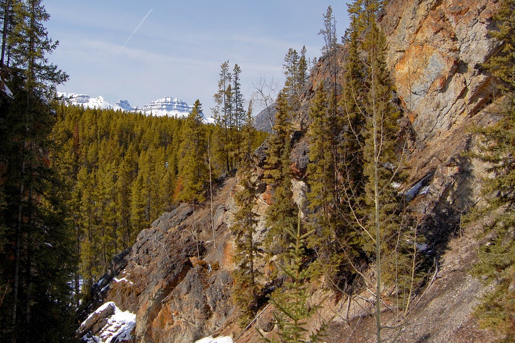


[6]


The trail and bicycle access ends at the Sundance Canyon picnic area. There a 1.2 km foot trail climbs into this canyon, bridging the Sundance Creek, and looping back down the other side of the canyon.


[7]


Just before the trail loops around there is a fork leading off through Sundance Pass to swing around the southern end of Sulphur Mountain to the Spray River for those considering that route.


Photo Credits: [1] melanie CC=nc-flickr, [2][3][4] eric titcombe CC=flickr, [5][6] John Vetterli CC-nc-nd-flickr, [7] casium CC=nc-nd-flickr.

Research: ParksCanada

Wednesday, 27 May 2015

Sheep River Provincial Park


Sheep River Provincial Park is located 106km SW of Calgary in Alberta. Take highways AB-22 and AB-546W, or AB-2A south to Otokoks, then west on AB-7 to Black Diamond and at Turner Valley to AB-546W, leaving 36km.

Sheep River is part of the Bow River watershed, providing drinking water to the towns of Turner Valley, Black Diamond and Okotoks.

The Sheep Falls are located near the Bluerock Campground and the Indian Oils Trail on the Sheep River Road at the western portion of the Park.

The park is open May 15 to November 30th each year which assists the Bighorn Mountain Sheep in maintaining their herd numbers. For the avid outdoors person there is camping, hiking, biking/cycling, fishing, horseback riding, and, of course, photographing birds and spectacular landscapes. For fishing enthusiasts a fishing license is required, and there is a catch and release in effect. This park is home to Cutthroat Trout, Bull Trout and Rainbow Trout. For the hiker often deer, elk, bear and Bighorn Sheep are seen.

For hikers there is information on the trails with Alberta Parks showing the degree of difficulty and more information. Group hiking is essential as this is bear country!

Historically, in 1884 to 1885 John Ware worked for the Quorn Ranch located on the Sheep River.

Photo Credit: phoven CC=flickr.

Research: wikipedia

AlbertaParks.ca

Thursday, 21 May 2015

Plains Bison in Banff National Park


Plains bison were reintroduced into Banff National Park in March 2015.


For those unable to watch embedded see here.


In the mid-1800s the majority of Plains Bison had been eliminated from the continent except for a few free ranging herds. They have always had a role in the ecosystem by their creation and maintenance of grasslands and meadows through grazing and physical disturbance of the ground. Bison are also a food source to predators.

The First Nations and pioneers benefited from the bison in years past. This reintroduction will assist the cultural reconnection which has been lost for over a century.

A long-term maximum population for Banff will be in the range of 600 – 1,000 individuals. To protect the initial relocation area it will only be accessed by established trails on foot or on horseback. For those who venture too closely the bison can create safety risks such as human fatalities. They weigh 450-900 kilograms, are agile for their size and capable of speeds up to 70 kilometres an hour. The areas of “the Panther and Red Deer River valleys, and the Fairholme Bench area of the lower Bow Valley” are locations that have the appropriate range habitat to support the bison.

The first phase of the reintroduction includes placing 30-50 bison in a temporary soft release paddock in the Panther-Dormer River area in the summer/fall. These plains bison will come from the herd at Elk Island National Park. The phasing in period will be over the next five years and beyond. Currently the Dormer River Valley is closed for prescribed fired burnings which will enhance new vegetation growth for the plains bison to be placed there.

This is exciting as it has been quite some time that Banff National Park has had the plains bison available to the public. During some of my early visits to Banff in childhood (late 1950s-1962), I recall seeing the plains bison in the various paddocks.


Research: ParksCanada

Saturday, 3 January 2015

Winter Necessity


Often in the winter months in western Canada, or in northern areas of Ontario and Quebec, plug-ins are necessary to keep engine blocks from freezing.

Winter has plagued western and eastern Canada in strange bursts of frigid weather combined with snow and freezing rain, followed by warmer weather. One never knows how the week will turn out, or just when that next heavy snowfall warning occurs.


Photo Credit: banff_lake_louise CC=nc-nd-flickr.


Friday, 17 October 2014

Saskatchewan Crossing


During the 1800s, the Saskatchewan Crossing was used by fur traders making their way into British Columbia. Located at the junction of the Icefields Parkway #93 and the David Thompson Highway in Banff National Park it offers a jumping off place for hikers and backpackers.

The Glacier Lake Trailhead can be located at the parking lot on the west side of the Icefields Parkway 1 km north of the Saskatchewan River Crossing Service Centre. The distance is 8.9km one way with an elevation gain of 210 m, and an elevation loss of 220m. The hiker is looking at 6 hours for a round trip.


Parks Canada provides information on activities available on its website.


Photo Credit: eurotrash CC=nc-sa-flickr.

Sunday, 15 December 2013

It's That Time of Year Again


This is a photo of the Flathead Range in the Crowsnest Pass in south-western Alberta.


Whenever the weather turns bitter cold with blowing snow the locals in Toronto complain initially and then they open up a little more to others in friendly gestures. Often the worst of the cold is over in a week; however, this time its continuing into a second week without much of a break. It warmed a little on Saturday to deliver snow and then the temperature dropped again. We should be counting our blessings and not encourage the deep freeze occurring in western Canada where Regina and Calgary have been experiencing -40C.

My absences from posting is due to personal matters taking a precedence. Two book reviews are nearing completion which should be posted soon.


Photo Credit: tipkodi CC=nc-nd-flickr


Friday, 22 March 2013


Once again, Blogger has decided to play games on whether I am allowed to upload photos for a hiking post on a trail in Glacier National Park in British Columbia.

However, this photo of Spirit Island at Maligne Lake in Jasper National Park, Alberta will suffice for the time being.

Photo Credit: alpeck99 CC=nc-nd-flickr CLICK TO ENLARGE

Thursday, 21 February 2013


This photo is of Consolation Lakes located in Banff National Park, Alberta.

I had intended on posting the book review on The Urban Fantasy Anthology, but for some reason Blogger insists on refusing the cover photo to upload.

From time to time I upload photos I intend on using in future posts, and this one was available. A previous post on hiking the Consolation Lakes is here.

The weather in Toronto continues to switch from week to week: snow and chilling winds bringing the temperature down to -25C and the next week 3C with rain. There have been major earthquakes over the last ten years that have been shifting the north pole to the NE degree by degree, which has an impact on weather everywhere on the planet.


Photo Credit: Whipstar CC=nc-nd-flickr.

Friday, 18 January 2013


Winter can be a wonderful time of year for various sporting enthusiasts: ice fishing, skiing, skating, tobogganing, walking in crisp cold air that numbs your nose while the snow crunches and squeaks under your boots. Though sometimes there isn't enough snow for sports. Like today: a bare covering of snow on the ground combined with a windchill. Perhaps kites with toque, two pairs of mitts, down-filled parka, woof scarf and various other wool garments underneath layered with soft cotton (rather than polyester which isn't healthy for you over the longterm). It's not pleasant walking in damp cold with a windchill of -18C (0F). The best thing about coming indoors afterwards is preparing a mug of steaming hot chocolate with a wee bit of cream to top it off.

It has been a very wierd winter so far with snow followed by mild temperatures, rain, then several days of sun and cloud ending in colder temperatures and a wee bit of snow. Yet in places meant to be warmer there has been snow: like in Sypria. Perhaps its the poles shifting every time there's an earthquake--some recent ones, over the last six months, on the west coast have been in the 7 scale. Or some years ago I'd read an article that said the planet was going into a water cycle which would create temperature change. Humans adjust just like nature does. We might complain a little but in the end we just go with the flow. Its much easier to do that in the beginning and avoid the tension.

How's your winter life going?


The photo is one of the waterfalls at the location of Elbow Falls west of Bragg Creek, Alberta.

 Photo Credit: "Elbow Falls" woldy CC=nc-nd-flickr

Thursday, 31 May 2012

This photo is of the Bow River heading east toward Canmore, Alberta from Banff National Park. My posts have slowed of late due to ongoing eye problems where I get flashes of light on either side which limits my use of the computer at this time. Thus, future posts are liable to be sporadic until I can get the situation under control. Getting older has its challenges. Photo Credit: pinkcanoe CC=nc-nd-flickr.

Friday, 13 April 2012

Stooking


During my youth my mother told me varying recollections of her childhood: of growing up on a farm in rural Alberta. One of those stories involved “stooking”. Today farmers put their hay up in stacked bales rather than sheaves set up in stooks that stand upright. A farmer would drive a two horse hitch pulling a flatbed wagon to drive between the rows to pick up the stooks to remove them to the barn or shed. Today a tractor is used with a baler attachment which packs the sun dried hay or green feed (oats not yet ripened) into a square bale or a large round bale and attaches twine to it to keep it secure until picked up.

Now, the story my mother told me dealt with her wanting to earn the same “extra” money her three brothers did by doing farm chores that involved heavier work like stooking in the fields when harvest came. She thought she was strong enough with the ability to do the same. Housework held no charm for her.

My grandfather, being a shrewd man, allowed her to stook the front corner field consisting of ten acres. Mother thought she would be working with dried wheat sheaves, but soon learned the task involved heavy green oats that hadn’t quite ripened in time for the harvest. Determined to get the job done she persisted.

Fortune shined on her that day. A grove of trees hid the field from the farm house. After several long back-breaking hours, a harvest work crew, hired to work in gangs for large farming operations, passed by on the road. Several of the men seeing my mother hard at work jumped down from the flatbed wagons and joined her in the field. They made short work of the stooking before running down the road to catch up to their ride.

Afterward my mother went to her father and told him she had completed the stooking in the field. He went out to see for himself, and without questioning her how she managed to get it done paid her the money.


Photo Credit: Ewing Galloway, The Book of Knowledge (1937) ,The Groiler Society, Limited, vol. 7, pp.1414. “corn stooks”

Sunday, 1 January 2012


This photo is taken in Kananaskis Provincial Park, Alberta.


With the New Year of 2012 upon us, I wish everyone a blessed and glorious time. Personally, I'm looking forward to the change of ages from Pisces to Aquarius in December: a new age which is said to bring peace, harmony and joyous love between people in a new "Golden Age". We will be leaving the Age of Pisces where people were forced to be under the control of others. Now is the time for every person to take control of their lives and see what measures they can assist in implementing to help others less fortunate or to see that proper safety measures are taken in environmental issues.

There are always a variety of avenues to be considered: safe health products, better standards for drinking water...i.e. is chlorine really safe to use? Chlorine is used in a variety of ways: to safeguard tap water, in disposable diapers, in bleach, in swimming pools, etc. The dangers of chlorine and its by-products is that it is linked to various forms of cancer. Are the chemicals used in household products, medical prescriptions, personal care items such as deodorant, soap, perfume, cosmetics, safe? Most are not. It's time for people to take an interest in what products they use and how they affect their lives and the lives of their families. Corporate companies are interested in the financial bottom line, not consumers' safety.

On a less serious note, winter did not really arrive in Toronto. It came for a couple of days after Christmas with a scattering of snow followed by mild temperatures and today it's raining with a temperature of 4C. The weather folks say it'll be a mild winter. Global change or is the planet wobbling lower these days? Ever noticed how the sun is located in a different position than when you were younger. Pay attention to where it sits above the horizon and where it sets. In 2010 in April a friend and I noticed that the sun was at an odd height at 4pm: quite high in the western sky when it should have been lower. Who out there has noticed the ground tremble just a little in the late afternoon or evening? A tremble almost imperceptible, but there. Any tremble more than this and my birds act up. Do you pay attention to what is going on around you, or are you more concerned about what's for dinner, or what movie you're going to, or how many emails you have to slog through at work? Take a few minutes and take a good look around you, feel the quiet in the park or is there something else there you didn't quite see before.

Some food for thought for the coming year. Be alert to new things and just maybe you'll experience something profound and new.

Photo Credit: D'arcy Norman CC=flickr.

Tuesday, 20 December 2011


This is taken along Highway 22 in southern Alberta showing the Livingston Range in first snow.

Of late I have been quite busy with personal matters and unable to post regularly. I hope things will settle down after the Christmas holidays so I can get back to doing my book reviews and historical posts which many of you enjoy.


Photo Credit: Gord McKenna CC=nc-nd-flickr.

Wednesday, 9 November 2011


One of many sights in rural Canada in the autumn is one of harvest, and placing cattle on mowed hayfiels. This photo was taken from Highway 22 near Longview, Alberta.

I favour the photographs of Mr. McKenna as he has one of those "eyes" for a shot that captures the essence of the view.

Photo Credit: Gord McKenna CC=nc-nd-flickr. CLICK TO ENLARGE.

Monday, 31 October 2011


This autumn view is of the Crownsnest River with Crowsnest Mountain on horizon in southern Alberta.

Photo Credit: tipkodi CC=nc-flickr. CLICK TO ENLARGE.

Monday, 25 July 2011


My posts of late have been rather sparse except for the book reviews due to further editing of my manuscript and drafting the subsequent ones.


Writing needs that initial leap to get started, followed by fortitude to get through the ideas that work and cut those that don't.


Often there are a multitude of distractions that have to be dealt with before returning to the crafting of a story that will be entertaining, perhaps even providing a new insight.


Of couse, once one manuscript is done then the querying starts to find a publisher. I'll be sure to let you know how that works out.


Photos were taken near Olds, Alberta.

Photo Credits: Boutofsocks CC=nd-flickr.

Saturday, 28 May 2011


This photo is of the Bow River at Canmore, Alberta.

Of late I've been stricken with a nasty infection that has decided to loosen it's hold. Thus, I'm on the road of repair and better health. And, just maybe, I'll be able to enjoy a walk in this lovely forested area again.


Photo Credit: 2BFotoguBkarten CC=nc-nd-flickr.

Friday, 1 April 2011


This is a view of the Rockies in southern Alberta from highway 22.

I've had difficulty with my internet provider resulting in getting a new connection. And it seemed today that it took far longer than necessary to even get on, but here I am.

Currently I'm in the last quarter of reading "Heartsone" by C. J. Sansom with the review following in the next couple of days.

I've been working on changes to one of my manuscripts in hopes of getting it out there to be looked at.


Photo Credit: Gord McKenna CC=nc-nd-flickr.

Thursday, 20 January 2011

Parker Ridge - Hiking Trails


[1-At parking lot just off the Icefield Parkway]


The hike to Parker Ridge is located in Banff National Park, Alberta and is one of the easier trails in the area.

Distance: 2.7 km one way
Elevation gain: 250 m
Maximum elevation: 2250m (7,380 ft)
Difficulty: moderate
Time: 3 hours round trip
Trailhead: Parking area on the west side of the Icefields Parkway,
4 km south of the Banff-Jasper boundary.


Check for snow conditions with ParksCanada before ascending as the trail may be snowbound in places making the destination inaccessible until early July.


[2]


This trail ends in a spectacular view of the Saskatchewan Glacier and surrounding mountains. It is a good idea to take a coat with you as the wind over the top of the ridge can be quite brisk.


[3]


It is a relatively easy trail through a forested area with swtichbacks that open up into alpine meadows with a variety of wildflowers during their brief flowering season in July.


[4]


Care should be taken to refrain from shortcuts on the switchbacks as this damages the fragile plantlife.


[5 - Trail and Icefield Parkway can be seen below]


Take your time on the switchbacks before becoming winded from the ascent.


[6 - Ribbon of Icefield Parkway seen below]


[7]


[8]


[9]


[10 - Cresting the top of the ridge]


[11]


[12 - Rocky Mountain Gaot]

These goats are often seen in the higher rocky terrain above the treeline. They tend to be shy of most humans.


[13]


[14]

The trail rises quickly above the treeline and crosses a high open ridge to an awesome view of the 9km long Saskatchewan Glacier. This glacier is an eastern branch off the Columbia Icefield.


[15]


[16]


This is another view of the Saskatchewan Glacier.


[17]


Source: ParksCanada

Photo Credits: [1][2][3][4][5][6][7][8][9][10][11][13][14][15][16]-mala_x1 CC=nc-nd-flickr, [12]-Dallas1200am CC=nc-nd-flickr, [17]-KB CC=nc-flickr.

Monday, 12 July 2010

My Town Monday - Samuel B. Steele - Kicking Horse Pass


[1 - Kicking Horse Pass - click to enlarge]


In 1885, the work on the Canadian Pacific Railroad was being made to reach the first crossing of the Columbia River, about 70 miles west of Laggan (Lake Louise)


[2 - Lake Louise train station today]


[3 - Laggan train station - 1889] link to photohere

to a place now known as Donald (named after Lord Strathcona. Donald is in the Rocky Mountain Trench near Marl Creek Provincial Park, B.C.).


[4 - Road in Kicking Horse Pass in 1920s - click to enlarge]


Samuel Steele was to ensure that the Mounted Police were in detachments along the CPR line during its construction. The railroad had constructed a Tote road to assist those working for the CPR to transport their supplies carried by horse and mule teams. Storage areas had been made at convenient distances which were overseen by a CPR employee. From these stores the contractors obtained what they needed for their contracts.


[5 - Tote Road (Eagle Pass Wagon Road 1885)]

The Tote road was cut out of solid rock near the Columbia River several hundred feet above. An exception to this was the Kicking Horse Flats near the Beaverfoot Pass.


[6 - Kicking Horse River Flats - click to enlarge]

The Kicking Horse Pass was named by Dr. James Hector, who had accompanied Captain Palliser during the exploration of western Canada in the 1850s. Hector explored the pass accompanied by a party of First Nations. At one of his camps he was kicked by a horse he had been trying to put a pack saddle on, breaking several of his ribs and knocking him unconscious. The natives thought he was dead, dug a grave and placed him in it. When they saw signs of life they removed him from the grave.

The Tote road near Golden was dangerous at any given point, especially at the highest being more than a thousand feet above the raging torrent of Kicking Horse River. Any horse that tended to shy or is too excitable in nature was considered not suitable for such a trip. Steele found that horses were unafraid of the precipice, but those horses that shied regularly would keep themselves well away from the rocky wall. On one trip Steele took one of the horses sent to the NWMP to Laggan from Calgary. At the most dangerous part of the Tote road Steele “met an Italian navvy with his bundle of blankets, and he, as was then the custom, instead of going to the right, planted himself against the wall of rock furthest from the precipice. At the sight of the extraordinary object, my horse, crazed with fright, whirled about, and I just saved myself and the horse by hurling myself on to the road.”

Steele, known for his strength, managed to keep hold of reins and bridle of the horse, whose hindquarters were over the precipice and its body resting on the edge. Steele's companion on a steady horse assisted in getting the horse back on the road. Steele sent the horse back to Calgary with a letter to the O.C. to send only horses accustomed to working in the mountains and not horses raised on the plains.

For other participants for My Town Monday go here.


TO BE CONTINUED

For previous posts on this series: Part 1, Part 2, Part 3, Part 4, Part 5, Part 6, Part 7, Part 8, Part 9.


Sources: Forty Years in Canada (1914) by Col. S.B. Steele, pp. 188-190

Photo Credits: [1]-Matthew Klassen CC=nc-nd-flickr, [2]-Rachelw123 CC=nc-nd-flickr, [3]-Glenbow Archives, [4]=Sherlock77 (James) CC=nc-nd-flickr, [5]-Wikipedia, [6]-babyonborg CC=nc-nd-flickr.