Showing posts with label Hiking Trails - Banff. Show all posts

Thursday, 25 June 2015

Hiking the Sundance Canyon Trail - Banff


[1]


Trail Length: 4.3 km taking about 3 hours
Elevation Gain: 145 m (470 ft)
Maximum elevation: 1545 m (5,070 ft)
Maps: Banff Up-Close (Gem Trek)


Check trail and bear conditions from Parks Canada before setting out. Recently the population of grizzly bears has increased and are more often encountered and seen around the Banff townsite. An article in the Calgary Herald in August 2013 reported an incident where a very large grizzly bear (225-275 kilogram) killed and ate a small 45-kilogram black bear that had been foraging on the trail.


From the intersection at the south end of the Bow River bridge make a right turn onto Cave Avenue. Go 1.2 km to the parking lot where a paved walkway leads to the Historic Cave and Basin site. Walk past to get to the hiking and bicycle path.

Some years ago, the paved road to Sundance Canyon was open to vehicular traffic. However, now it is used only by hikers, horses and those who wish to bicycle or use roller blades.

The first portion of the trail leads down to the Bow River.


[2]


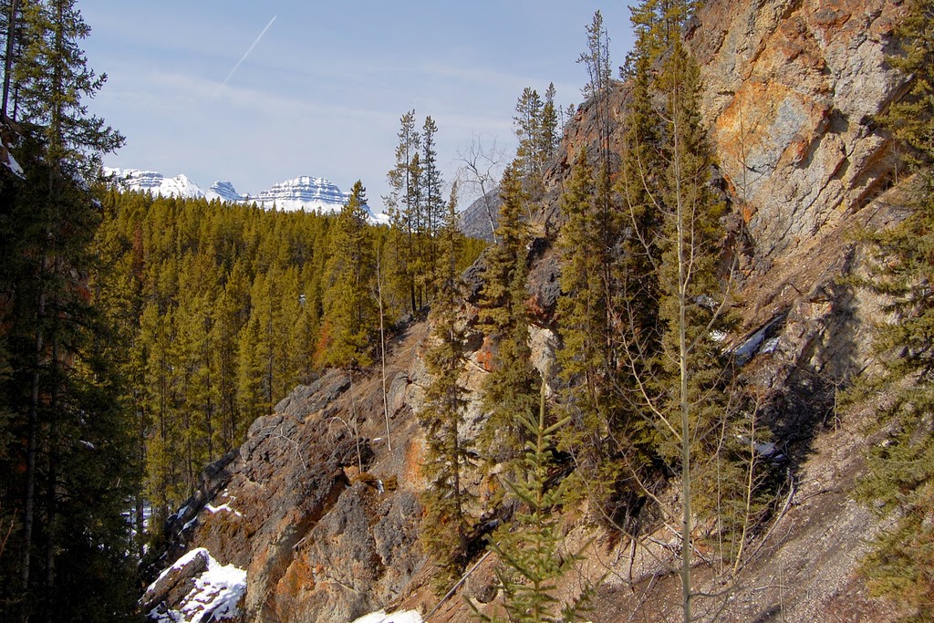
For about 1.5 km the trail follows the shoreline of the Bow River before turning south toward Sundance Canyon. Views of Mt. Cory 2789m, Mount Edith 2554m (the spike top), Mt. Norquay 2525m can be seen to the north.


[3]


[4]


[5]


[6]


The trail and bicycle access ends at the Sundance Canyon picnic area. There a 1.2 km foot trail climbs into this canyon, bridging the Sundance Creek, and looping back down the other side of the canyon.


[7]


Just before the trail loops around there is a fork leading off through Sundance Pass to swing around the southern end of Sulphur Mountain to the Spray River for those considering that route.


Photo Credits: [1] melanie CC=nc-flickr, [2][3][4] eric titcombe CC=flickr, [5][6] John Vetterli CC-nc-nd-flickr, [7] casium CC=nc-nd-flickr.

Research: ParksCanada

Friday, 17 October 2014

Saskatchewan Crossing


During the 1800s, the Saskatchewan Crossing was used by fur traders making their way into British Columbia. Located at the junction of the Icefields Parkway #93 and the David Thompson Highway in Banff National Park it offers a jumping off place for hikers and backpackers.

The Glacier Lake Trailhead can be located at the parking lot on the west side of the Icefields Parkway 1 km north of the Saskatchewan River Crossing Service Centre. The distance is 8.9km one way with an elevation gain of 210 m, and an elevation loss of 220m. The hiker is looking at 6 hours for a round trip.


Parks Canada provides information on activities available on its website.


Photo Credit: eurotrash CC=nc-sa-flickr.

Tuesday, 22 February 2011

Hiking Trails - Bow Glacier Falls


[1] Highway 93N - Icefields Parkway headed south to Bow Lake and Crowfoot Glacier on Mt. Crowfoot, 3050m (10,007 ft).

This hike is located in Banff National Park just off the Icefields Parkway. Please consider there is the possibility of rapid weather changes and take rain gear along as sudden showers are likely in and around the many icefields present in this area.

Distance: 4.6km one way, takes about 2 hours for one way
Elevation Gain: 155m
Trailhead: 36km north of the Lake Louise Junction on the Icefields Parkway. Turn off at the Num-Ti-Jah Lodge Access Road on the west side of the highway. The trailhead kiosk is 400m down this access road.


[2] Num-Ti-Jah means ‘pine marten’.

The mountain behind the lodge is Mount Jimmy Simpson 2966m (9730 ft) named after an early well respected outfitter who arrived from England in 1896, built the Lodge Num-Ti-Jah for his patrons. Jimmy Simpson died in 1972 at the age of 95. Simpson commented about the area: "There is absolutely nothing in the city to give us the same feeling as the great, mysterious things of nature even though they be stone and ice. It is only among them that we feel the utter helplessness and insignificance of ourselves."*


[3]

For those interested in staying at the Num-Ti-Jah Lodge I have provided the link. Though a bit pricey I think a full package with breakfast, packed lunch and dinner would be the ticket for a glorious stay of a night or two.


[4]


[5]

The pointed bump to the right of Bow Glacier is Portal Peak, 2911m (9550 ft) was named by Charles s. Thompson in 1916. This is in the direction the hike destination to Bow Glacier Falls.

The trail follows the northern edge of Bow Lake.


[6]

There are several bridges that cross streams.


[7]

At the lake outlet there are gravel bars and a plain with the falls visible in the distance.


[8]


[9] Gravel bars


At the end of the plain are a set of stairs needed to reach the falls. There are about 65 steps to the top, set in an irregular fashion.


[10]


[11]

As the hiker ascends the stairs various views of the Bow River gorge can be seen.


[12]


It is near here, before the top of the stairs are reached , where a branch off trail to the left goes to the Bow Hut (run by the Alpine Club of Canada. or those considering this route there is a daunting bridge of a large limestone boulder that crosses the gorge.

Above the stairs the trail reaches a crest on a glacial moraine where there is a 45 minute hike to the falls.


[13]

The falls originate from a fair sized lake below Bow Glacier which is unseen from below lying in a basin below the toe of the receding glacier.


[14]


[15]

Bow Glacier Falls are the headwater of the Bow River.


[16]
View from bottom of bow glacier falls.


[17]- View from sitting near base of Bow Glacier Falls looking down to Bow Lake.

For those intrepid hikers who happened to carry along proper equipment and ropes a scramble up the rocks to the glacial lake at the toe of the Bow Glacier will reveal an awesome sight.


[18]


[19] Bow Glacier with view of the sharp spire of St. Nicholas Peak, 2970m (9750 ft) located on the eastern edge of the Wapta Icefield.


Photo Credits: [1]-Alaskan Dude CC=flickr, [2]-cblee CC=nc-sa-flickr, [3]-surfma CC=nc-flickr, [4][12]-richd777 CC=nc-sa-flickr, [5]-wikimedia commons, [6]-retropc CC=nc-sa-flickr, [7][9]-Gouldy99 CC=nc-nd-flickr, [8]-bolinhanyc CC=nc-flickr, [10][11][14]-BinoCanada CC=nc-sa-flickr, [13]-felix63 CC=nc-nd-flickr, [15]-miss a CC=nc-sa-flickr, [16][17]-lyzadanger CC=nc-sa-flickr, [18][19]-Stefatty CC=nc-sa-flickr.

Sources: *peakfinder.com
ParksCanada

Thursday, 20 January 2011

Parker Ridge - Hiking Trails


[1-At parking lot just off the Icefield Parkway]


The hike to Parker Ridge is located in Banff National Park, Alberta and is one of the easier trails in the area.

Distance: 2.7 km one way
Elevation gain: 250 m
Maximum elevation: 2250m (7,380 ft)
Difficulty: moderate
Time: 3 hours round trip
Trailhead: Parking area on the west side of the Icefields Parkway,
4 km south of the Banff-Jasper boundary.


Check for snow conditions with ParksCanada before ascending as the trail may be snowbound in places making the destination inaccessible until early July.


[2]


This trail ends in a spectacular view of the Saskatchewan Glacier and surrounding mountains. It is a good idea to take a coat with you as the wind over the top of the ridge can be quite brisk.


[3]


It is a relatively easy trail through a forested area with swtichbacks that open up into alpine meadows with a variety of wildflowers during their brief flowering season in July.


[4]


Care should be taken to refrain from shortcuts on the switchbacks as this damages the fragile plantlife.


[5 - Trail and Icefield Parkway can be seen below]


Take your time on the switchbacks before becoming winded from the ascent.


[6 - Ribbon of Icefield Parkway seen below]


[7]


[8]


[9]


[10 - Cresting the top of the ridge]


[11]


[12 - Rocky Mountain Gaot]

These goats are often seen in the higher rocky terrain above the treeline. They tend to be shy of most humans.


[13]


[14]

The trail rises quickly above the treeline and crosses a high open ridge to an awesome view of the 9km long Saskatchewan Glacier. This glacier is an eastern branch off the Columbia Icefield.


[15]


[16]


This is another view of the Saskatchewan Glacier.


[17]


Source: ParksCanada

Photo Credits: [1][2][3][4][5][6][7][8][9][10][11][13][14][15][16]-mala_x1 CC=nc-nd-flickr, [12]-Dallas1200am CC=nc-nd-flickr, [17]-KB CC=nc-flickr.

Wednesday, 12 January 2011

Consolation Lakes - HIking Trails


[1 - Road to Moraine Lake - click to enlarge]

The closest town to Moraine Lake and the Consolation Lakes is Lake Louise in Banff National Park.


[2 - On Moraine Lake Road cresting ridge - click to enlarge]


[3 - Moraine Lake]

Moraine Lake is nestled in what is known as the Valley of the Ten Peaks. These are known as the Wenkchemna Peaks which are 3,000m (10,000 ft) high.


[4]


Distance: 2.9 km (1.8 mi) one way, taking 2-4 hours round trip
Elevation Gain: 65m (213 ft).
Trailhead: the bridge at the rear of Moraine Lake Picnic Area.


This hike is considered easy to moderate.

This area is prime bear country and hikers are required to travel in groups of 6. A good recommendation would be to wear proper walking shoes or hiking boots as the terrain will be rough in spots and there is crossing of scree and bouider strewn areas.

The trail begins by crossing Moraine Creek at the southern outlet of the lake.


[5 - Trail]


The trail proceeds around the rockpile.

There is another trail here that leads up to the top for a nice view of Moraine Lake.


[6 - Crossing stream]


[7 - Yellow Rumped Warber]

This bird was previously known as the Myrtle Warbler in the east, and Audubon’s Warbler in the west. In the summer these birds can be found across the top of the continent and they migrate to Central America in the fall. Its diet consists of bayberries, wax myrtle berries, insects, spiders, and fruit. During the breeding season it builds nests in confiers, laying 4 to 5 white eggs with brown and gray spots. The eggs are incubated for 12 to 13 days with the hatchlings leaving the nest in 10 to 12 days. Size 5 ½ inches.

The trail passes the Tower of Babel, 3,00m (10,170 ft) located on the right (west).


The trail moves through subalpine forest of Engelmann spruce and fir.


Just before the Lower Consolation Lake the trail opens into a large lush meadow.


[8 - Meadow and Panorama Ridge to the east in the background]


Lower Consolation Lake is contained by a large rockslide from the Tower of Babel.


[9 - Lower Consolation Lake with Tower of Babel in background on left]

As stated at Peakfinder.com: ""Tower of Babel," the top of which is over 700 metres below the summit of Mount Babel.Walter Wilcox named the Tower of Babel after it reminded him of the story in the bible in which the Tower of Babel reached to the heavens. It was a huge rockfall from the Tower of Babel which formed the dam which holds back Moraine Lake. Walter Wilcox had thought when he named the lake that the rocks were carried forward by an advance of the glacier in the valley and left as a terminal moraine."


[10 - Consolation Lake - click to enlarge]


[11 - Consolation Lake looking north to Mount Temple - click to enlarge]


[12 - Consolation Lake - click to enlarge]


[13 - Hoary Marmot]


[14 - Imposing cliffs of Mount Babel]


[15 - Scree slope]


Continue to Upper Consolation Lake by crossing Babel Creek where the trail follows a rather wet trail along the eastern shoreline and areas of scree that can pose a hazard to the unwary hiker.


[16]


The summits of Bident Mountain and the four peaks of Quadra Mountain rise from a spectacular glacier lying above steep cliffs at the southern end of the valley containing Consolation Lakes.


[17]


Sources: ParksCanada, A Field Guide to the Birds of North America by Michael Vanner, Paragon, 2006, p.211.

Photo Credits: [1]-jockrutherford CC=sa-flickr. [2]-marketingfacts CC=nc-flickr. [3] wikimedia commons. [4] Balykat CC=nc-flickr. [5][6][8][12][14][16][17] subindie CC=nc-nd-flickr. [7] whipstar CC=nc-nd-flickr. [9] Borkybash CC=nc-sa-flickr. [10] Binoo CC=nc-nd-flickr. [11] pencrush CC=nc-nd-flickr. [13][15] listentoreason CC=nc-sa-flickr.